
Recently, during one of our visits to Israel, we decided to make an additional stop over in Turkey. While investigating the interesting sites of Turkey, we read a lot about a specific site. It is said that this site could be the resting place of Noah’s ark. As we believe the Scriptures to be true and accurate, we do not need proof of the flood or Noah’s ark. However, we have never been to eastern Turkey and have heard good things, so we decided to include this in our trip. The trip was really alluring and fascinating. Please also note that we are not professional archeologists or geologists, thus this is purely a trip report of what we saw, not a scientific report.
Before telling you what we saw, let me give you a bit of a historical background to the site of Noah’s ark in Turkey. There are, today, still a lot of different opinions regarding the validity of this site among the professionals. They have proof for and against the claim that this is the original resting place of Noah’s ark. My intentions is not to provide proof for either side of the argument, but purely to provide you with a report of what we did and saw.
History of the site
The first record to look at is the verse in Genesis that refers to the resting place of the ark.
Genesis 8:4-5
4 In the seventh month, on the seventeenth day of the month, the ark rested upon the mountains of Ararat. 5 The water decreased steadily until the tenth month; in the tenth month, on the first day of the month, the tops of the mountains became visible.
Most of us have been taught that the ark came to rest on mount Ararat. If you reread this verse, you will notice that it is actually a plural being used “mountains.” The word “Ararat” is also not referring to a specific mountain, but to a country. This can be seen in the other verses where the word was used.
2 Kings 19:37
37 It came about as he was worshiping in the house of Nisroch his god, that Adrammelech and Sharezer killed him with the sword; and they escaped into the land of Ararat. And Esarhaddon his son became king in his place.Isaiah 37:38
38 It came about as he was worshiping in the house of Nisroch his god, that Adrammelech and Sharezer his sons killed him with the sword; and they escaped into the land of Ararat. And Esarhaddon his son became king in his place.
The word “Ararat” is the word “Urará¹u†in the Akkadian language. Urartu was an important nation around Lake Van in Armenia. It is now divided between Turkey, the Soviet Union, Iran, and Iraq. 1 Thus we know that the ark came to rest on a range of mountains in the land of Urartu, a pre-Armenian kingdom. In modern Turkey, we have two peaks named Ararat. We have Greater Ararat (Agri Dagi in Turkish from the Ottoman period, meaning “heavy mountain” ) that is 5,137 meters tall and Lesser Ararat that is 3,896 meters high. The two peaks originate from the same base. Mount Ararat is located in the Eastern Anatolia Region of Turkey between DoÄŸubayazıt and IÄŸdır, near the border with Iran. The greater peak is a volcano that last erupted in 1840, but this is reported to have happened under the ground water level.
The oldest non-Biblical reference we have of the ark existing can be traced back to the historian Flavius Josephus. He has the following quotes:
This Berosus, therefore, following the most ancient records of that nation, gives us a history of the deluge of waters that then happened, and of the destruction of mankind thereby, and agrees with Moses’s narration thereof. He also gives us an account of that ark wherein Noah, the origin of our race, was preserved, when it was brought to the highest part of the Armenian mountains –Against Apion I, 19
We can see from this quote Josephus was aware that the Babylonian priest historian, Berosus, from around 300 B.C. was still writing about the ark in Armenia that people were taking parts of as charms. He also mentions several other historians that referred to the story of Noah’s ark. It is speculated that at some point, the ark was covered by a mud and/or lava flow which caused future generations to lose its location.
In May 1948, the area in modern Turkey near the village of Uzengili received a lot of rain and was also hit by three earthquakes. The combination of wet soil and earthquake activities, unearthed the remains that are today claimed to be Noah’s ark. This structure was discovered by a local shepherd called Reshit Sarihan in May 1948.
In October 1959, a Turkish captain, Lihan Durupinar, noticed a strange formation on a photograph that was made as part of the NATO Geodetic Survey (a system that preceded the modern GPS system). Durupinar informed the Turkish government of his findings. Others in the US then analyzed these photos. Included among them was Dr. Arthur Brandenburger, a renowned expert in photogrammetry (the practice of determining the geometric properties of objects from photographic images.) An expedition sponsored by the Archeological Research Foundation, including Rene Noorbergen (reporter, author and Seventh-Day Adventist), George Vandeman(evangelist), Ä°lhan Durupınar, and Arthur Brandenberger, surveyed the site in September 1960. Their expedition is recorded in the book “The Ark File” that was written by Rene Noorbergen3. After two days of digging and dynamiting inside the “boat-shaped” formation the expedition members found only soil and rocks. Their official news release concluded that “there were no visible archaeological remains” and that this formation “was a freak of nature and not man-made.” In the book, it is recorded on page 129 that Dr. Brandenberger believed that:
- It was difficult to explain this formation as a natural geological occurrence. A number of his friends were in agreement with this statement, after viewing the slides that were taken at the site.
- He felt that the expedition was too negative in their official statements released to the press.
To quote “and I am not anymore so sure that, from a serious scientific standpoint, a sole surface archeological investigation of only two days entitles us to state that the formation is not the ark.”
This site was then unexplored until 1977, when Ron Wyatt, an amateur explorer and Seventh-Day Adventist, began to explore the site. He started with his first trip to Turkey in August 1977 and made several more trips until 1991. During this time, he made many trips and performed a number of different tests at the site. These included radar scans, sample by drilling into the surface, surveys with metal detectors and subsurface radar scans in 1985. More details of all his expeditions and findings can be found at the Wyatt Museum website.
During the trip in 1985, Ron was joined by David Fasold and geophysicist John Baumgardner. Fasold later recorded his experience in his book “The Ark of Noah.” Originally, Fasold was convinced that the site contained the remains of an ancient boat. After a number of expeditions, he changed his opinion. In 1996, he co-authored a paper entitled “Bogus ‘Noah’s Ark’ from Turkey Exposed as a Common Geologic Structure” and also testified before the court in Australia that this site was not Noah’s Ark. However, it is reported by several of his friends,4 including his close Australian friend and biographer June Dawes, that he had returned to the opinion that it was the fossilized remains of Noah’s Ark.5
On 20 June 1987, the site was officially dedicated by the Turkish Government as the place of “Noah’s Ark.” They also announced plans to build a tourist information center at the site (which they did.) The site was turned into a national park, which means that no further excavations are allowed.
Anchor stones
During his first trip to Turkey in 1977, Ron Wyatt, together with David Fasold, also found what they called “anchor stones.” These are large stones with a hole at the top. Fasold interpreted the artifacts as drogues, stone weights used to stabilize the Ark in rough seas, on the grounds that they all have a chamfered hole cut at one end as if to fasten a rope to them, and because the existence of such stones was suggested by his reading of the Epic of Gilgamesh. The drogue anchor stones were used in the past to stabilize ships. It was not used to keep a ship from moving, like normal anchors do. Several of these drogue anchor stones have been discovered in the Nile, the Mediterranean sea, the eastern Atlantic and off the coast of California.
Here, they discovered a total of thirteen stones. These are the largest drogue stones that have been discovered to date. The original estimates put some of these stones at around 700kg. The ones that have been found so far are more or less in a line with the boat shape.
Ten of the original thirteen stones contain carvings that resemble crosses from the Byzantine period. Three of the stones that were buried had no markings on them.
Our Trip
During our trip to Jerusalem for Shavuot, we decided to make a stop over in Turkey. In our search for places to see and visit, we found the information on Noah’s ark. We had a chat with Joseph Dumond, who had done the trip in 2007, and he strongly recommended that we make the trip if possible. Joseph furthermore warned us that it would not be your average tourist outing. He had done it before and wrote extensively on his website about his visit and findings. You can start reading here. Joseph also has a number of pictures from his trip in his gallery. In his articles, Joseph also goes into a great more detail than I do. Please make the time to read the articles that he has written, as you will learn a good deal more than what I covered in this report.
To get to the location, you first need to fly to Istanbul and then continue your trip via airplane to Van. The moment you disembark from the plane, you realize that you are now off the beaten track. If your plane is the only one at the airport, the airport has just one terminal and you walk across the runway to the terminal, then it is not your average tourist hot spot.


When we had collected our bags, we discovered that our driver had not arrived yet. After waiting a while we made a phone call, only to discover that there was no driver on the way. We could rent a car (only one they had left) and drive ourselves to Dogubeyazit. The area around Van was hit by a severe earth quake (7.1) in October 2011 that killed 534 people. The area is still being rebuilt with a number of housing projects still under construction. The trip from Van to Dogubeyazit is a 3-hour drive through a very scenic part of the Turkey. On the way, you travel past Lake Van, the largest lake in Turkey, that is 119km wide at it’s widest point. This is one of the few lakes around the world that have no outlet (endorheic lake.) Due to it’s high salinity the lake does not freeze, even though it is at an altitude of 1,640 m (5,380 ft), and the area is known for some harsh winters.

Along the way, you notice that you are now in an area that has volcanic activity. Along the road, you see huge areas of black lava stone in the middle of green pastures. Dogubeyazit is a relatively small town (70,000 residents) in the eastern part of Turkey, near the border with Iran (approx. 35km) and 15km from Mount Ararat. The town is surrounded by some of Turkey’s highest mountain peaks, including Ararat and Tendürek Dağı. It is in the heart of the Kurdish part of Turkey and a lot of people we met were Kurdish The town receives a lot of tourists, who mainly come to either climb Mount Ararat or travel through on their way from Iran to Istanbul or Ankara (Silk Road Tour.) We did not see many Western tourists during our stay of three days in the town. The hotel we stayed at was in the old part of town and had a beautiful view of the peaks of Ararat.


We spent the first day driving from Van and recovering from our travels. We also did a bit of sightseeing in the town.
The next morning we headed out to the site accompanied by our guide. The hotel we stayed at is a family-owned business with the dad and a number of his sons working at the hotel. One of the younger sons was tasked with acting as our guide. He was relatively proficient in English and had grown up in the area. His dad was born in the village next to the site. His family has stayed at the village for more than nine generations and still owned some land within the area around the village. Later in our visit these connections came in very handy! When we wanted to head out to the visitor’s center, we heard from the hotel staff, that the center was not always open. What a disappointment! We travel all the way to hear that we may not be able to visit the site. This was the first time the local connections helped. One of the sons, picked up his mobile phone and called the caretaker of the visitor’s center on his mobile phone. Sure, he would open the center for us. What a relief.
The trip to the site is a couple of minutes drive from the town. Along the way, we saw a number of small villages, and then came across the road sign that points you to Nuh’un Gemisi (Noah’s Ark).

From the main road, you have to drive 5 more kilometers up some dirt roads to get to the visitor’s center. The visitor’s center is small building near the village of Uzengili. This is the village where our guide’s father grew up and a lot of his family still stays. The village’s name was recently (1950s) changed to a more Turkish name. Earlier, the village was known by it’s Kurdish name of Nisir. It was originally part of the Kurdish state of Bayazid.


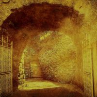
As you can see in the picture, the visitor’s center is not in a very good condition, but still contains some very interesting information. The caretaker of the center, was very helpful. Normally, people are not allowed to visit the Ark itself, but after a kind word from our guide, we were told that we may go down to the site to have a look around. Once again, our local connections opened a door for us. It took a couple of minutes to make our way downhill to the site of the Ark. Due to all the rain that they had received the previous week, the hill was quite slippery, and we had to take it slow.
Once you get down to the site, you start to realize exactly how big this structure actually is. The outlines of the ark can be clearly seen, with a large stone in the center of the structure. If you view the site via Google Maps, you will notice that the Ark is currently in the middle of what appears to be flow of lava or mud from the opt of the mountain. Thus, it has been assumed that the current location is not the original resting place of the Ark. The Ark had come to rest higher up in the mountains and had moved down with the slide. Eventually, it got caught on the rock that is now protruding from the middle of the shape.


We did not measure the structure’s dimensions; this was done by Joseph during his visit in 2007. All I can say is that you cannot get a realistic view of the size from these pictures. To give you a bit more perspective, let us look at a picture from the tail end, facing towards the front. Notice again the rock formation protruding from the ground in the middle.

To give you some perspective, here are my wife and son on top of the tail piece of the structure.

The sides of the structure are a couple of meters high and completely covered in soil. We did not make any attempt to dig or analyze the structure in any way. As we are not trained in any of the sciences related to this type of inspection, we would not even know when we found something of importance. What was interesting is the lines that develop along the sides. I do not know if this is common or if it indicates that there is another structure below the surface. What also stood out for me, is the natural stream that developed next to the side of the ark. My logic tells me that if the formation was not natural, the water stream would have developed next to the side of the structure. Once again, this is pure speculation as I am in no ways trained on the subject.


Our stroll around the site also revealed some very interesting findings. For me the most engaging was what appears to be a piece of fossilized coral. In the visitor’s center they also showed some pictures of something similar. However, this piece that we saw, was exceptionally big. How does coral get this high in the mountains if you do not believe in the flood? If coral could get this high up, why not the ark?

We also saw a couple of places where the soil showed some really interesting patterns. This included some pieces of soil that looked more like rotten wood than like the soil that was found everywhere else. In a number of other places surrounding the structure, we also noticed some very interesting color patterns in the soil. I am no expert but to me, this look like some iron somewhere in the soil. We did not see this pattern repeat if we go away from the structure.


These findings confirmed for me that we are most likely not dealing with a normal geological occurrence. There is something more to this place.
The Anchor Stones
Leaving the site of the Ark, we now wanted to see if we could get to Arzap where the Anchor Stones are. Our guide knew exactly where to find these. Along the way, we noticed that the locals had a very interesting source of heat during the winter. They would collect all the animal dung, mix it with water and then let in dry in the sun. Once sun dried, these are cut into blocks to be burned during the winter. I am sure it does not smell great, put I am convinced it is far less polluting than a lot of other stuff being burned for electricity.

After a short drive through some very rural areas, we arrived in the village. The village is also referred to by the name of Kazan. What can be seen at this site is a large number of stones that stand upright. Some of these stones have holes (one or two) at the top, and some have the remains of what could have been holes. These stones with the holes in are what is referred to as the anchor stones. These stones are really large and heavy and would require a number of big, strong men to move them. As noted before, most of these stones have crosses from the Byzantine period on them. We were also shown a very interesting stone, that is now being used by one of the villagers as a gate post, that has the drawing of a soldier with a sword on it. What was most fascinating for me was the form of the sword. It is not a straight sword, as would have been the case of the crusaders, whom many claimed, put these markings on.


A bit to the other side of the village, you can see a large number of stones, without any holes, that all have these similar crosses on. We are told by the locals that these are headstones of graves, that were most likely placed here by the Armenians. This part of Turkey used to be under Armenian rule for a long period of time. We also found one of the rocks that had some writing on it. It is done in a language that I could not recognize. A bit further away, we found a place where the locals had started to take out some of the sand to use for building. Here, we could see that there are graves below these stones. The locals confirmed that they do find remains of human bodies when they dig near these stones.


 In the area, we also saw another stone that was shaped in a very strange form. Nobody could clarify for us the purpose or origin of the stone.

The next interesting finding is the drawing that is made on one of these stones. One theory explains this as a drawing of a ziggurat. A ziggurat is a massive structure that was built in Mesopotamia for religious reasons. Some also claim that the tower of Babel was most likely built in this pattern. Remains of these structures can still be found in Iraq and Iran. It was typically a pyramidal structure with a flat top built in receding tiers. This is a fairly close description of what can be seen on this rock.

In our discussion with the locals of the village, they told us that this was actually a drawing of an Armenian church that used to be close by. Apparently, the Turkish government had entered the area earlier and destroyed anything that could allow the Armenians to claim possession over the land. These people also told us that this was done by bulldozing a lot of structures and stones that existed in this specific region. They claimed that some of the stones of this Armenian church are still where the original church was built. Although this does explain the “grave yard” with the specific forms of the cross, it does not really provide an explanation for the holes in some of the stones. The villagers also told us that there were more of these stones in the area and that some of them has already been destroyed.
Next day
What we could not visit on the first day was the village of Naxuan / Mesha-Naxuan (Gen 10:30). This is claimed to be the village where Noah originally resided after disembarking from the ark. We also wanted to see the rocks Dr. Brandenburger had found and claimed this could have been the rock that Noah made his sacrifices on. Our investigations and discussions could not lead us to a clear position. Thus, we had to rely again on the personal connections to find more information. This eventual lead us to the president of the village, who tried to find us more details on what we were looking for.
So the next day we went back to the village of Uzengili to see if we could find what we were looking for. The president of the village sent us one of the elders from the village to help us look. However, the search was fruitless due to our time constraint. We did end up driving very high up on the mountain towards Iran. From there I wanted to confirm the theory of the slide that had caused the Ark to move. Once we got so close to the border, that I could see the guards in the towers, it was possible to get a great view of the valley from the top. If you look down the valley, you can clearly see the path that was formed by the slide. It is not so easy to capture that in pictures, but I tried my best. In the first picture, you can see the visitor’s center in the far distance (middle of picture) from higher up in the mountain. The village of Uzengili is visible to the left and towards the right is another smaller village. Clearly there exists a natural path that could have been created by a mud slide.


While I was up there looking around with the people from the local village, we did see a number of military vehicles along the road where we had left the car.

Conclusion
We really did see a lot of things that convinced me that this is most likely not a natural formation. I will have to rely upon the research that was done by many, more experienced in this field. A lot of them claim they have found enough scientific evidence to be able to make the claim that these are the remains of the Ark. If you also read through all the investigation Joseph Dumond had done before his trip, it becomes even more difficult to claim that this is a purely natural rock formation. Unfortunately, we could not see all we wanted to see. 
Reference
- Hamilton, V. P. (1999). 169 ×ֲרָרַט. (R. L. Harris, G. L. Archer Jr., & B. K. Waltke, Eds.)Theological Wordbook of the Old Testament. Chicago: Moody Press.
- Josephus, F., & Whiston, W. (1987). The works of Josephus: complete and unabridged. Peabody: Hendrickson.
- The Ark File, Google Books – http://books.google.com/books?id=JCJfT2QmNtwC&lpg=PA152&pg=PA126#v=onepage&q&f=false
- Deal, David Allen (2005). Noah’s Ark: The Evidence. Muscogee, OK: Artisan. ISBN 0-933677-02-2
- Dawes, June (2000). Noah’s Ark: Adrift in Dark Waters, Belrose, NSW; Noahide. ISBN 9780646402284


Leave a Reply to Tim Warner Cancel reply